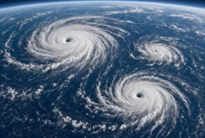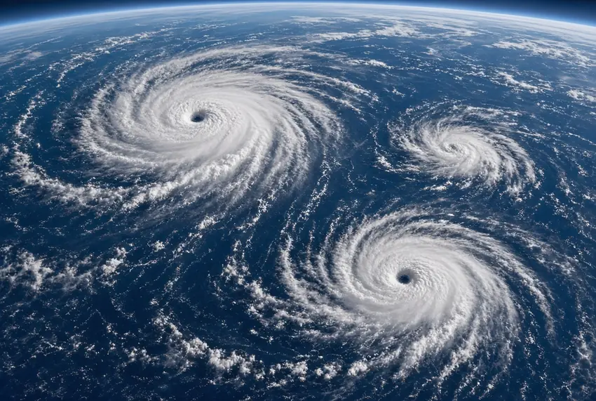

Pacific cyclones are making headlines as a rare trio of storms moves across the ocean this week. Scientists link the unusual activity to a powerful El Nino that has heated tropical Pacific waters far above normal levels.
Hurricane Lowell leads the group furthest west. Close behind is Hurricane Karina. Both storms have reached Category 4 strength. The National Hurricane Centre expects them to pass south and northeast of Hawaii, though some uncertainty remains about exact paths. Gustier trade winds and extra rainfall could still affect the islands because of Lowell.
Hawaii is still recovering from Hurricane Lala, which recently brushed the Big Island with damaging winds and flash floods. Behind the two major hurricanes sits Tropical Storm Marie, currently a few hundred miles south of Baja California. Forecasters say Marie is likely to strengthen into a hurricane later today.
Climate scientist Julia Cole from the University of Michigan explained that El Nino warming creates ideal conditions for these storms. Warm ocean water fuels their power, so periods of higher temperatures often bring stronger and more frequent systems. Seeing three cyclones lined up at once is rare, she noted. A similar train of four storms appeared in 2015 during another intense El Nino year.
This year’s El Nino already carries a 69 percent chance of becoming the strongest on record, according to the National Oceanic and Atmospheric Administration. Even before its expected peak around November, it is driving extreme weather worldwide. In Peru, warming seas have sharply cut anchovy catches, hitting the world’s largest producer. In Sudan, delayed rains linked to the pattern have lowered Nile River levels.
El Nino is the warm phase of a natural Pacific cycle that returns every few years. When trade winds weaken, warm water shifts eastward and rises to the surface. This change boosts storms and clouds over the region and alters weather patterns around the globe, bringing wetter conditions in some areas and drought in others.
Climate change is amplifying these effects. A warmer atmosphere holds more moisture, so rains tied to El Nino can become heavier. Drier soils also worsen drought where the pattern reduces rainfall. Research on coral records shows that El Nino events have grown more intense over the past four decades compared with pre-industrial times.
As the three storms continue their path, meteorologists are watching closely. The combination of unusually warm waters and the rare cyclone train highlights how strongly this El Nino is shaping weather across the Pacific and beyond.